For several years, GEO Solutions has organized the Strava Challenge, a sports promotion based on the well-known running app. Because Strava has an API that we – as creative developers – can do a lot with.
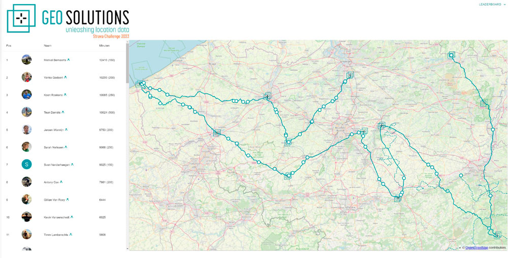
Competitive colleagues who want to participate in the Strava Challenge link their profile to a dashboard that has been customized. On July 1, the starting gun will be fired and “intense” competition will begin immediately. During that time, you see people walking all over the office and you see “walking meetings” in the parking lot.
For all
The Strava Challenge was developed with inclusivity in mind: not just for runners, that is. The idea is that anyone can participate, even with simple exercise minutes by walking; Although you will get a “slowpoke” badge as a playful nod. There are also separate challenges each month to earn extra minutes. For example: the longest distance, altimeters, the most beautiful nature photos, …
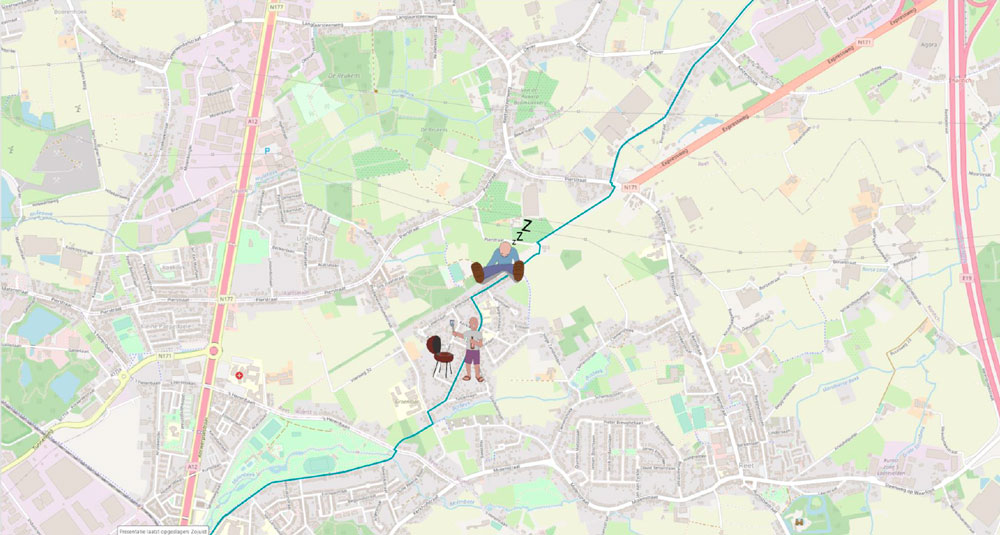
The end result in the image below is a route from our headquarters to the location of the team building weekend. Each point represents the distance traveled by a peer, which we call “linear referencing” in GIS terms.
What’s next?
The entire platform is built with open source elements and gets upgraded every year. What we invented this year? You can follow that on our LinkedIn profile.
The finale
The winner will be announced during the annual team building weekend by the sea. There are prizes for the winners, for those who have been active for at least 10 minutes a day as well as for those who have simply participated. Everyone’s a winner, in other words. And rightly so, as long as you keep on moving!